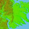
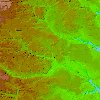
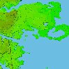
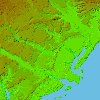
These maps are linked to graphic images
that represent possible levels of Flooding due to Hurricane Storm Surges
at 10 and 20 feet. They are intended for educational purposes only.
Actual flooding conditions at these levels will vary due to a number of
factors, including; heavy rainfall associated with hurricanes, funneling
affects at the head of bays, and other factors.